
Utility Investigation Services
Call Certerra Subsurface before you cut, core, drill or dig.
Uncover what lies beneath the surface with precision. Our subsurface investigation services reduce strike risk, prevent costly delays, and provide the accurate data you need to keep projects safe and on schedule.
Utility Investigation Services
Why Utility Investigation Services Matter
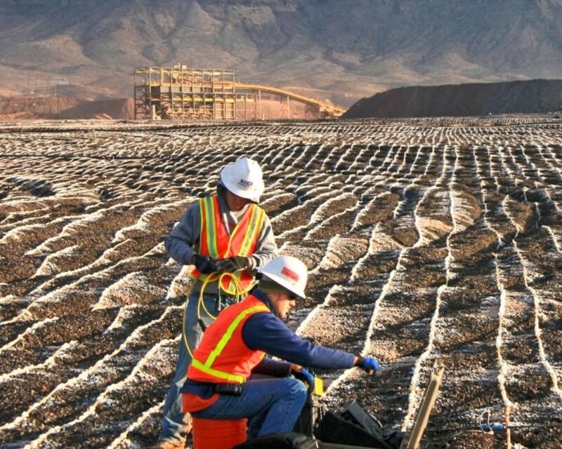
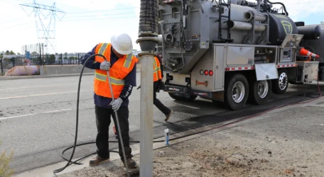
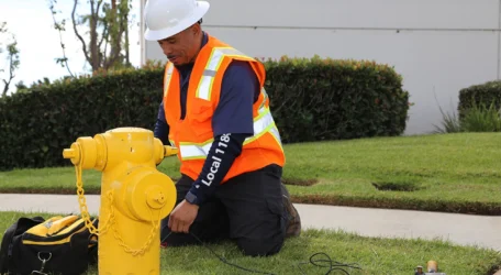
When you work with Certerra Subsurface Imaging, we accurately locate underground utilities to protect clients and the public. Using state-of-the-art equipment and highly trained professionals, we provide Subsurface Utility Investigations, Vacuum Excavation, and Utility Depiction for metallic and non-metallic utilities, including water, gas, power, communication, and reinforced concrete structures.
Utility Investigation Services
Utility investigation services combine locating, mapping, and direct verification to clarify underground conditions. Field-based methods are selected based on site constraints and project needs. The result is documented, defensible utility information that supports safer excavation, improved coordination, and reduced project risk.

Utility Investigation Services
Methods Used for Utility Locating
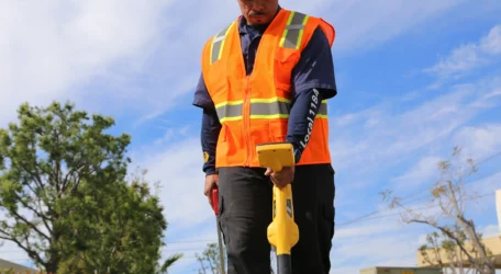
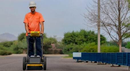
Electromagnetic locating is a common and cost-effective approach for identifying buried utilities. It is often the first step in a broader subsurface investigation and may be combined with other methods depending on access, utility type, and site conditions.
Direct Connect Locating
Transmitter directly connected to utility or tracer wire to send a locatable signal.
Induction Locating
Signal induced through the surface when direct connection to the utility is not possible.
Passive Locating
Receiver detects naturally occurring electromagnetic fields emitted by energized utilities.
Utility Investigation Services
Understanding Utility Data Quality
The quality of underground utility information directly affects project risk, planning, and cost control. Quality levels represent degrees of confidence in utility data and help project teams decide how much information is required to safely design, construct, or excavate in congested subsurface environments.
Quality Level A is the highest level of accuracy and involves the full use of the subsurface utility investigation method. It provides information for the precise plan and profile mapping of underground utilities through the nondestructive exposure of underground utilities, and provides the type, size, condition, material and other characteristics of underground feature.
Quality Level B involves the application of appropriate surface geophysical methods to determine the existence and horizontal position of virtually all utilities within the project limits. It addresses problems caused by inaccurate utility records, abandoned or unrecorded facilities, and lost references. Decisions regarding location of storm drainage systems, footers, foundations and other design features can be made to avoid conflicts with existing utilities. Slight adjustments in design can produce substantial cost savings by eliminating utility relocations.
Quality Level C involves surveying visible utility facilities (e.g., manholes, valve boxes, etc.) and correlating this information with existing utility records (QL-D information). When using this information, it is not unusual to find that many underground utilities have been either omitted or erroneously plotted. Its usefulness, therefore, is primarily on rural projects where utilities are not prevalent or are not too expensive to repair or relocate.
Quality Level D is the most basic level of information for utility locations. It comes solely from existing utility records or verbal recollections, both typically unreliable sources. It may provide an overall “feel” for the congestion of utilities but is often highly limited in terms of comprehensiveness and accuracy. QL-D is useful primarily for project planning and route selection activities.
Reduce Utility Uncertainty
Utility investigation services combine locating, verification, and documentation to clarify subsurface conditions. Field-verified information supports safer excavation, improved coordination, and informed decisions where underground utilities affect planning and construction.