

Certerra Subsurface Liner Leak Location – Pinpointing industrial pond liner leaks
News2 Mar 2026
Traditional mine tailings disposal involves depositing a slurry of saturated material into an impoundment or dam. The tailings often have very small grain size, high water-retention capacity, and typically sit above unlined bedrock. A major concern for these facilities is the long-term geotechnical stability and retention of high levels of metals.
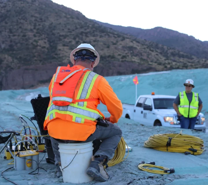
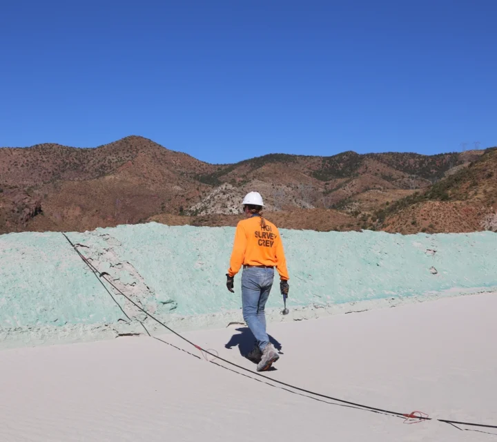
Tailings contain significant water and provide a large gradient for metal transport, making their composition an important target for characterization. We use geophysical methods such as electrical resistivity, induced polarization, and thermal monitoring to track solutions stored in tailings piles to their original sources, enabling effective controls to be implemented before environmental impacts occur.
Tailings with high water content create a risk of solution leaving the site and impacting groundwater, wetlands and streams. Long-term geotechnical stability and retention of elevated metal levels are also major concerns. Our geophysical mapping technologies help to provide reconnaissance-level characterization to trace contaminants from source to impacted area as well as map the strength of underlying host rock.
By applying these characterization methods, operators gain insight into internal water-metal transport, enabling the identification of solution sources and pathways, and the implementation of controls to stop unwanted flow into sensitive areas. Ultimately this provides a clearer picture of the waste body’s behavior and supports effective long-term management.
Our methods support comprehensive geophysical characterization by combining multiple measurement and imaging approaches. Together, they provide complementary perspectives on internal tailings behavior, helping clarify subsurface conditions, fluid movement, and material stability essential for understanding long-term performance.
Multichannel Analysis of Surface Waves measures seismic surface waves to determine subsurface stiffness and layering characteristics.
Learn how tailings dam mapping enhances subsurface understanding, supports risk management, and strengthens confidence across the tailings facility life cycle.
Tailings dam mapping is a broad-characterization process using geophysical methods and analytical interpretation to visualise internal structures, fluid pathways, and heterogeneities within the impoundment and its foundation.
Techniques such as electrical resistivity, induced polarization (IP), seismic refraction or MASW allow non-invasive mapping of saturation zones, structural layering, and preferential flow paths without extensive drilling.
Frequency depends on facility activity, construction stage, and risk profile; many operators integrate mapping into routine monitoring schedules or during key operational transitions.
During closure, mapping helps verify internal conditions (e.g., drained state, liner integrity, residual fluid movement), supports closure monitoring plans, and informs reclamation and water-balance strategies.
Understanding internal conditions within tailings dams is critical to managing uncertainty. Tailings dam characterization provides field-verified insight into subsurface conditions to support monitoring strategies, planning efforts, and informed decision-making.
Loading...

