

Certerra Subsurface Liner Leak Location – Pinpointing industrial pond liner leaks
News2 Mar 2026
Dam seepage mapping uses a suite of geophysical techniques—like electrical resistivity, seismic, nuclear magnetic resonance, and streaming potential—to image the internal structure of dams, embankments, and levees. It identifies zones of abnormal seepage or piping, helping to assess integrity and mitigate failure risk.

Our dam seepage mapping adapts multiple geophysical methods such as electrical resistivity, seismic, nuclear magnetic resonance (NMR), and streaming potential, to image internal saturation, density, and flow dynamics within earthen structures.
Electrical resistivity tracks saturation by measuring conductivity contrasts within the dam structure. Seismic surveys detect weak or low-density zones through sound-wave velocity analysis, identifying internal voids or anomalies. NMR provides insight into water content within dam materials, while streaming potential directly senses subsurface water flow. Together, these methods reveal seepage pathways and structural vulnerabilities before they compromise dam integrity.
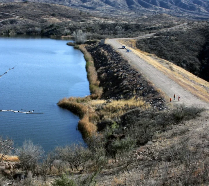
Seepage and internal erosion are the second-largest cause of earthen dam failures worldwide, often resulting in structural collapse, property destruction, and loss of life. Our geophysical toolbox helps locate abnormal seepage, piping, and internal flow paths within dams, embankments and levees—enabling targeted investigation and mitigation before major damage occurs.
We use multiple geophysical methods to detect and map seepage within dam structures. These non-invasive techniques image internal saturation, identify flow pathways, and detect structural anomalies, providing the comprehensive subsurface data you need to assess seepage risks, prioritize interventions, and protect dam integrity before failures occur.
Electrical resistivity measures variations in subsurface electrical properties to reveal differences in material composition.
Learn how dam seepage mapping works, why it’s essential for dam safety, and how our geophysical methods help engineers, regulators, and asset managers detect seepage pathways, reduce risk, and make informed maintenance decisions before failures occur.
Dam seepage mapping uses geophysical techniques to image the internal structure of earthen dams and detect zones of abnormal water flow, moisture, or erosion.
Mapping is important for dam safety because seepage and internal erosion are among the top causes of earthen dam failure, mapping helps identify risk zones before serious damage occurs.
Internal conditions are revealed through multiple methods (resistivity, seismic, NMR, streaming potential) each sense different physical properties—moisture, density, flow—to build a holistic interior image.
Yes. These geophysical techniques probe the subsurface without requiring destructive drilling or excavation.
Seepage within dams and foundations can indicate changing internal conditions. Dam seepage mapping provides field-verified insight into seepage pathways to support monitoring strategies, maintenance planning, and informed dam management decisions.
Loading...

