Certerra Subsurface Liner Leak Location – Pinpointing industrial pond liner leaks
News2 Mar 2026


It’s never a good construction day when a damaged pipe bursts.
Each utility system laid beneath the surface is part of an intricate network of sewers, pipes, tanks, ventilation, and drainage ports. Without proper planning, it becomes much easier to hit a pipe than avoid it.
That is why it is essential to use underground utility mapping technology. Read on to learn about the key benefits it provides.
During the planning stage of a construction project, it can be difficult to account for every specific code regulation in the surrounding area of California. If an issue arises, deciding on the best course of action can delay a project by weeks.
Before beginning any part of the project, it is better to understand the scale of what pipes need to be repaired, patched, and brought up to code. Our underground utility technology supports this process by providing CCTV inspection video directly on the property. We can assess sewage lines and piping and report what needs to be addressed before digging begins.
If there is ever a question about pipe regulation, this is the best time to resolve it so you have the right supplies and information ready for quick decision-making.
Some situations require an immediate response, not only to determine accurate information but also to protect worker safety. But how can assessments be made in areas that are not visible to the eye?
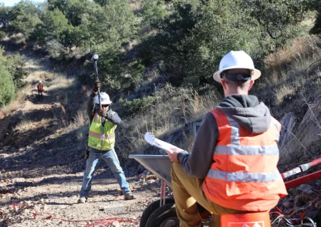
Underground utility mapping is one of the fastest ways to identify exactly what needs to be found in the moment. Our professional team can come on-site and provide emergency potholing for visual verification checks of underground utility locations. This is especially useful when there is uncertainty around electrical line size and depth.
One of the most obvious benefits of mapping is the amount of money it can save. All too often, projects go over budget after unexpectedly running into utility lines.
It can also lead to delays and replanning for more accessible routes. Much of this can be avoided by investing in a professional underground utility report. Our reports provide detailed information on the complex subsurface beneath a property, helping save both time and money.
The goal is always to avoid major disturbances or accidents when digging, but if an incident does occur, mapping can help with that too. All of our information and documents can be shared with the repair teams involved. We can pinpoint, trace, and share location data directly with responders through our public utility reporting, helping issues get repaired and resolved as quickly as possible.
At Certerra Surface Imaging, our underground utility mapping services are changing the way companies design and innovate. They provide invaluable support in complex utility environments, ultimately saving time and money for all departments involved.
Loading...