

Certerra Subsurface Liner Leak Location – Pinpointing industrial pond liner leaks
News2 Mar 2026
Solutions for a complex world: Seismic Surface Waves
As engineering and consulting professionals, we often face the challenge of designing projects over and across unknown subsurface conditions. Geologic features, visual inspections, infrastructure, and historical documents can only provide clues about what is happening beneath our feet. Geophysical tools, such as seismic methods, offer a cost-effective way to quantitatively understand large subsurface areas.
Seismic methods are among the most widely used exploration techniques in the geotechnical industry. Seismic investigations have helped improve understanding across many geological, geotechnical, and hydrogeological projects. A variety of techniques can be used, including seismic refraction, seismic reflection, and multi-channel analysis of surface waves (MASW).
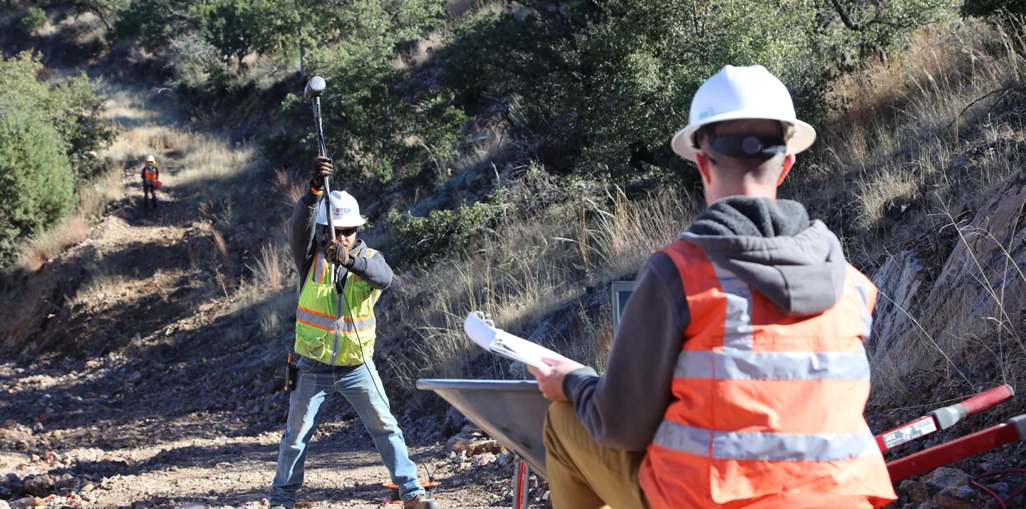
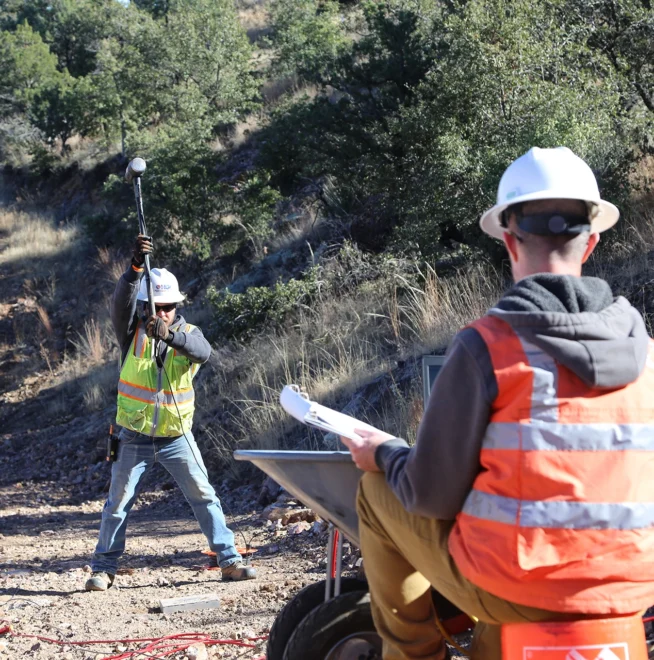
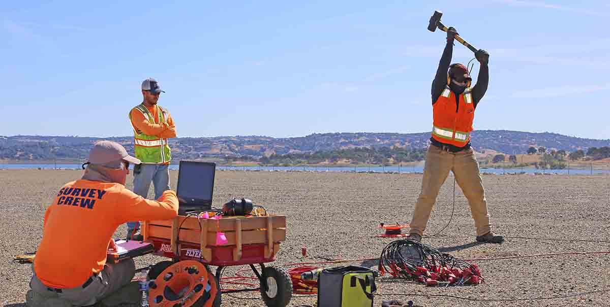
The MASW method is based on the measurement of surface wave energy, also known as ground roll. A seismic wave is introduced into the subsurface, typically using a hammer blow or an accelerated weight drop. Energy radiates outward from the source point, with higher-frequency surface waves traveling nearer to the surface and lower-frequency surface waves penetrating deeper. This energy is detected at the surface by a series of regularly spaced receivers, known as geophones.
A seismograph records the travel time and amplitude of the energy from the source to the receivers. The fundamental property used in MASW is dispersion, or the change in phase velocity with frequency, which allows us to model the shear wave velocity of the subsurface.
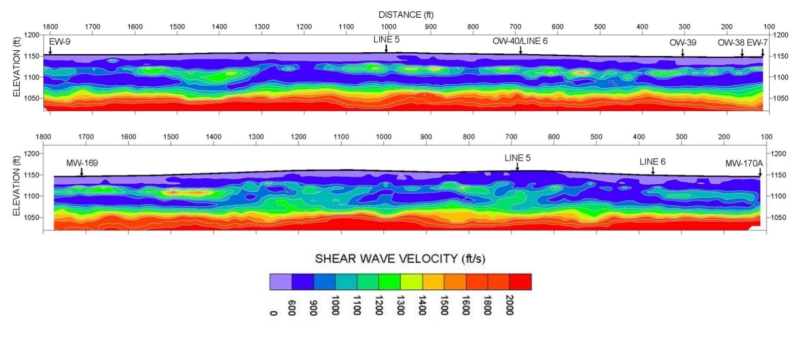
The MASW method provides a direct indication of soil stiffness and is well suited to identifying soft soil zones, cemented sands, and depth to bedrock. These profiles show the variability of a cemented sand layer within sediments overlying bedrock. These results were used to determine the optimal placement of groundwater extraction wells to remove contamination.
The MASW method is ideal for investigating layered media and identifying velocity inversions that other seismic methods may struggle to detect, such as soft soil zones beneath stiff or cemented soil, or weathered bedrock beneath more competent bedrock. HGI has conducted surveys in a wide range of environments, from large-scale surveys in rugged terrain to small-scale surveys in dense urban areas.
The MASW method can be applied to many areas, including depth-to-bedrock surveys, stratigraphic mapping, void detection, and seismic hazard determination.
If you have a project where surface wave imaging could benefit you or your client, contact us and we will work with you to design a specialized survey. We are passionate about what we do, and we take pride in providing an honest assessment of the possible applications and limitations of geophysical technologies.
About the Author: Jeremy Strohmeyer | Certerra Subsurface Imaging

Loading...