Certerra Subsurface Liner Leak Location – Pinpointing industrial pond liner leaks
News2 Mar 2026
If you’re looking for your ultimate guide to utility potholing, we’ve got you covered. Here’s what you should know.
Are you just starting a new construction contract?
Underground utility mapping is often a legal requirement for new projects. Without an accurate map, there is a real risk that the work becomes both costly and dangerous.
According to a government survey, accurate utility mapping resulted in an 89% reduction in personal injury accidents. It also increased the likelihood of projects being completed on time and helped save upwards of $700,000.
If you’re picturing messy and precarious exploratory digs and potholing, you’ve come to the right place.
Let’s take a closer look.
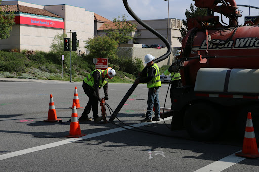
Utility potholing, also known as hydro excavation or air excavation, involves creating a test hole to expose subsurface utilities.
Hydro excavation relies on high-pressure water to break through the earth, while air excavation uses air pressure.
Air excavation is a less disruptive approach, which means excavated material can often be reused. On the downside, it usually takes longer and is less effective in denser or harder soils.
Other types of potholing include traditional hand digging and backhoeing, as well as less destructive methods such as vacuum excavation.
Whatever approach you take, utility potholing helps ensure that gas, water, and electrical lines remain undisturbed and undamaged.
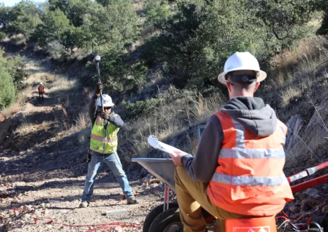
For civil engineers, contractors, and project managers, determining the exact location of both vertical and horizontal utilities can be time-consuming. Even so, it is an essential part of any excavation project.
Fortunately, technological advances have led to underground utility scanning, which reduces the need for labor-intensive and destructive methods when mapping utilities before excavation.
When potholing, the principal utilities contractors look for are color-coded. In the US and Canada, the American Public Works Association’s (APWA) color-coding system is used:
In 2003, the ASCE, or American Society of Civil Engineers, developed the US standard for Subsurface Utility Engineering. The information available at each quality level helps determine the level of risk used to design and construct a project.
These quality levels allow project managers to note the accuracy of the information they find and put themselves in a much better position to manage potential risk.
This information can come from sources such as:
According to the ASCE, there are four levels of information for utility locating. These range from Quality Level A, the highest, to Quality Level D, the lowest.
This level provides the most accurate information on subsurface utilities and allows data to be collected through non-destructive methods.
It can identify subsurface utilities and specify details such as:
It can also define other relevant characteristics, along with horizontal and vertical positioning. This data helps contractors map utilities in congested or built-up urban areas.
This level is often used to provide preliminary information at the beginning of construction projects.
It uses Subsurface Utility Engineering (SUE) to identify the presence of utilities and their horizontal position.
This level is usually compared with data gathered at Quality Levels C and D. That helps correct inaccurate, missing, or unrecorded utility records.
It also helps manage utility locations and design adjustments by locating pre-existing features such as:
This can help reduce the cost of expensive utility relocation later on.
This level uses surveys of visible facilities such as manholes, fire hydrants, meters, and valve boxes.
It also uses information found at Quality Level D to identify utilities that may have been incorrectly plotted or omitted.
This is often useful for rural projects where relocation and repair are relatively inexpensive, or where many utilities are present.
This is the most basic level of information because it relies on existing utility records or verbal recollections, which can often be unreliable.
Information can also be sourced from geographic databases, construction plans, and distribution maps. However, it does not usually provide an accurate or comprehensive picture of utility locations.
Even so, it can be useful for initial route selection and early project planning. At this stage, it gives a general sense of where utilities may be present.
For this reason, Quality Levels D and C are often used first to develop planning strategies that minimize risk and avoid relocation across the wider project area.
As the specificity of information increases, the exact project area can be investigated more closely at Quality Levels B and A.
The key method for utility locating at these levels is electromagnetic locating. This technique works by detecting the electromagnetic field around utilities.
This can happen either passively, where the utility emits naturally occurring detectable radio frequencies, or actively, where a technician induces the frequency.
It is a cost-effective way to investigate the exact location of utilities before and during excavation, although it is often used alongside several other tools. The most common electromagnetic locating methods include the following:
This direct connect method requires physical access to the service, usually at the surface where the feature connects to the utility.
The technician sends a tracer signal through the line while using a receiver above ground to read the frequency. This method is ideal for electrical, communication, and gas lines.
Electromagnetic induction is used for locating buried services that cannot be directly connected for one reason or another.
For example, utilities can be identified and traced through an alternating electrical current sent to the line. The utility then transmits the signal back through the transmitter, which is detected above ground. This helps estimate both position and depth, much like the direct connect method.
Sonde locating can identify buried water lines, gas pipes, and other non-magnetic utilities. Sondes are self-contained transmitters inserted into a utility or conduit, and receivers can detect them from above the surface.
Using tools such as crawler cameras, push cameras, and ramrods, technicians can establish the utility’s full path rather than just its endpoint. For example, blockages can be found by pushing the sonde forward until it stops and then locating that exact position.
The last method passively detects naturally produced frequencies from buried utilities. For this to work, the line generally needs to be an active electrical power or communications line that is already emitting a signal.
Once utilities have been located, the technician uses the appropriate industry color-coding to mark their position directly on the surface.
Water-based paint is generally used, but when that is not possible, chalk, wax, or other marking materials can be used instead. The area above may then be designated with flags or whiskers to highlight the project area.
Now that you have the basics of utility potholing, you may be wondering where to go for the most accurate and comprehensive utility information for your project.
You needn’t look further than Certerra Subsurface. We use some of the most advanced equipment in the industry to gather the information you need for successful project management. Our approach is tailored to the specific requirements of your project, and our technicians are experts in underground utility locating and mapping. So why not get a free estimate today?
Loading...