

Certerra Subsurface Liner Leak Location – Pinpointing industrial pond liner leaks
News2 Mar 2026
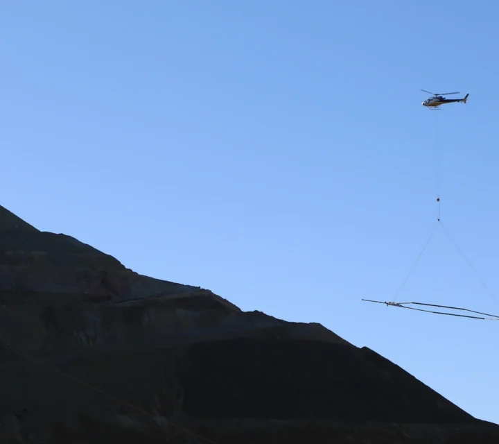
The airborne electromagnetic method (AEM) provides rapid subsurface assessment by measuring electrical conductivity and resistivity from an airborne platform. This technology enables large-scale data collection without ground contact, delivering efficient coverage of extensive areas and deep exploration capabilities for complex geological environments. AEM is recognized for its adaptability and proven reliability, offering deep exploration capabilities and accurate information calibrated for each project.
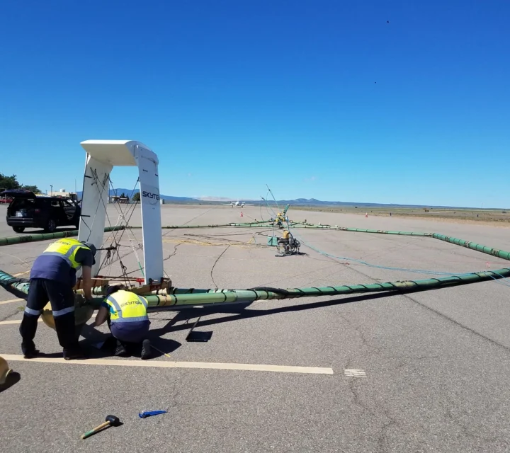
AEM operates by transmitting a time-varying current through a loop suspended from an airborne platform, generating electromagnetic waves that penetrate the ground. When these waves encounter different materials, they induce eddy currents that create secondary electromagnetic fields. Sensors detect how these fields diffuse through the subsurface. The rate of diffusion reveals resistivity variations, enabling detailed mapping of underground structures.
Subsurface complexity often limits traditional investigation methods, especially across large or inaccessible areas. AEM addresses these challenges by enabling rapid, wide-area data acquisition to depths exceeding 1,000 feet. It helps overcome issues related to incomplete or localized measurements, providing continuous profiles that reduce uncertainty. By revealing electrical variations, AEM supports accurate interpretation of geological conditions, mitigating risks tied to hidden structures or material inconsistencies. Its ability to deliver reliable insights at scale makes it essential for resolving spatial gaps in subsurface knowledge.
Learn how the airborne electromagnetic method works, why it matters, and how AEM helps you rapidly assess large areas, map deep subsurface conditions, and make informed decisions for exploration and site characterization.
AEM is a geophysical technique that measures subsurface electrical conductivity and resistivity using electromagnetic fields generated from an airborne platform. It provides a rapid and non-invasive way to collect large-scale data without direct ground contact. This method is widely used for mapping variations in subsurface properties over extensive areas.
AEM surveys can typically investigate subsurface conditions to depths of about 1,000 to 1,200 feet. The exact depth depends on factors such as system configuration, terrain, and the conductivity of the materials being measured. This deep penetration makes AEM suitable for large-scale regional studies.
Yes, AEM is specifically designed for use in areas that are hard to access by traditional methods. Its airborne nature allows surveys over rugged landscapes, wetlands, and other challenging environments. This capability makes it ideal for large-scale regional investigations.
AEM data is highly accurate when properly calibrated and integrated with other datasets. The technology uses advanced sensors and modeling techniques to minimize errors and improve resolution. This ensures reliable interpretations for complex geological environments.
Electromagnetic methods help identify conductive subsurface features and material contrasts. Field-verified electromagnetic data supports characterization, planning, and informed decisions where subsurface conditions are not fully known.
Loading...

