

Certerra Subsurface Liner Leak Location – Pinpointing industrial pond liner leaks
News2 Mar 2026
Electromagnetic induction methods measure naturally or artificially induced electric and magnetic fields to identify variations in subsurface electrical properties. By detecting conductivity contrasts, EM reveals the presence of fluids, metals, and geological features, supporting investigations ranging from shallow mapping to deep characterization of groundwater, geothermal, and mineral systems.
Electromagnetic induction methods generate a primary electromagnetic field that spreads above and below the ground, inducing electrical currents in subsurface conductors. These induced currents create secondary electromagnetic fields that distort the primary field. A receiving coil measures the resulting variations in intensity, phase, or direction, revealing the presence and characteristics of conductive materials.
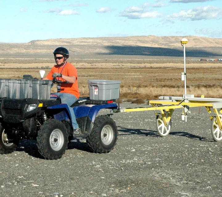
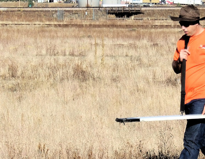
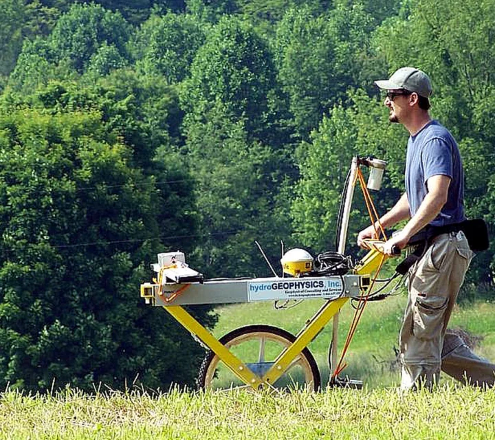
EM instruments do not require direct ground contact, enabling rapid, efficient data collection. Methods vary by source type: continuous-wave (frequency-domain), transient (time-domain), and natural-source magnetotelluric approaches. Frequency-domain methods use sinusoidal transmitters to measure in-phase and quadrature components, while time-domain systems measure the decay of eddy currents after the primary field is shut off.
Electromagnetic induction excels at mapping variations in electrical conductivity that reflect differences in subsurface materials, fluids, and geological structure. EM methods rapidly locate buried tanks or pipelines, delineate landfill boundaries, map conductive soil or groundwater contamination, and identify zones of enhanced soil moisture or salinity. They are also effective for characterizing hydrogeologic settings, locating buried channel deposits, identifying conductive fault or fracture zones, and mapping structural features.
Because EM does not require ground contact, it provides rapid coverage for reconnaissance-level surveys or large-area mapping. Frequency-domain systems are ideal for identifying lateral conductivity changes, while time-domain methods help evaluate conductive bodies at depth. Natural-source EM techniques extend investigations even deeper by measuring naturally occurring electromagnetic energy.
Electromagnetic induction delivers rapid, non-contact measurements that reveal conductive variations across shallow and deep subsurface environments. Users gain immediate insight into where fluids, metals, altered materials, or geological contrasts occur, enabling efficient mapping of broad areas and identification of features that influence environmental, hydrogeologic, and structural behavior.
Because EM responds directly to electrical conductivity, it highlights subsurface regions that may control fluid flow, influence geochemical processes, or host structural irregularities. Frequency-domain, time-domain, and natural-source EM methods each provide unique perspectives on conductivity distribution, allowing tailored investigations that match site conditions and project goals.
Learn how electromagnetic induction methods to map conductivity variations using frequency-domain, time-domain, and natural-source approaches. Below are some FAQ’s that may be helpful.
Electromagnetic Induction identifies fluids, metals, conductive soil or groundwater contamination, faults, fractures, buried objects, and structural variations.
EM depth depends on frequency, coil geometry, and method type; some approaches image shallow features, others deep structures.
EM advantages include rapid, non-contact detection of conductivity variations across a wide range of environments.
Electromagnetic induction is a geophysical method that measures induced electric and magnetic fields to map variations in subsurface electrical conductivity.
Electromagnetic induction provides rapid insight into subsurface conductivity variations across a site. Field-verified EMI data supports identification of material changes, buried features, and conditions that influence subsurface planning and investigation.
Loading...

